Mtirala National Park in Adjara, Georgia, is a haven for hikers and nature enthusiasts. This article delves into the park’s trails, including the Tsabinari Waterfall Loop, Mtirala Extended Loop, and the challenging Didi Tirala Mountain route. Additionally, the Tsabinari (Chestnut forest) Trail and Tsivtskaro route offer immersive experiences in the park's diverse ecosystem. This factual overview provides essential information for planning a visit to this unique natural area.
Mtirala National Park: A Rich Ecosystem
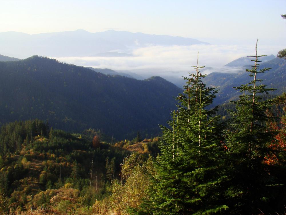
Mtirala National Park, spanning about 15,698 hectares (38,790 acres), is nestled in the western Lesser Caucasus, strategically positioned between the Black Sea and the Adjara Mountains. As part of the Colchic Rainforests and Wetlands, a UNESCO World Heritage Site, the park boasts a rich array of flora and fauna. The dense forests are home to species like the brown bear, roe deer, and the Caucasian viper. Interestingly, Mtirala's name, translating to "to cry," reflects its high annual rainfall of 4,520 millimeters (178 inches), one of the wettest regions of the former Soviet Union.
Hiking the Trails: Tsabinari Waterfall and Beyond
The Tsabinari Waterfall trail, a 7.7-kilometer (4.78 miles) loop, offers a moderately challenging hike. With an elevation gain of 440 meters (1,444 feet), it takes roughly 2 hours and 53 minutes to complete. This trail, popular for its scenic views and the waterfall, provides a mix of adventure and tranquil moments, especially during quieter times of the day.
The Mtirala Extended Loop
For those seeking a more challenging adventure, the Mtirala Extended Loop spans 12.4 kilometers (7.7 miles). This trail, known for its demanding terrain, usually takes about 5 hours and 33 minutes to complete. It offers a unique opportunity to explore the park's more remote areas, often without the presence of many other travelers.
Didi Tirala Mountain: A Trail for the Experienced
The Didi Tirala Mountain trail, stretching 28.6 kilometers (17.77 miles) with an elevation gain of 1,524 meters (4,999 feet), is designed for the experienced hiker. Taking an average of 10 hours and 22 minutes to complete, this out-and-back route starts from Makhuntseti or Zundaga. The trail is renowned for its breathtaking views of Batumi city and the Black Sea, and water sources are available throughout the route.
Tsivtskaro: A Two-Day Nature Immersion
The Tsivtskaro route, beginning at 260 meters (853 feet) and ascending to 1,250 meters (4,101 feet), is a two-day journey through Colchic broad-leaved mixed forests. The route is ideal for observing wildlife, with opportunities to spot animals like the European Badger and Chamois. The trail features natural springs, picnic areas, restrooms, and a shelter for eight people. The untouched beech groves on the second day provide a serene environment for both relaxation and scientific observation.
Practical Information for Visitors
Situated in the westernmost part of Georgia, the park is approximately a 6-hour drive from Tbilisi. These trails, built with support from the World Wildlife Fund, offer a diverse range of experiences for hikers of different skill levels. When planning a visit, it's essential to consider the trail difficulty, duration, and the park's unique climatic conditions.